Difference between revisions of "Map"
(Created page with "Four distinct maps can be encounter while playing UnReal World. In the beginning of a players adventure, a world is created and its map is displayed. All the player character'...") |
m (adding category tag) |
||
| (5 intermediate revisions by one user not shown) | |||
| Line 1: | Line 1: | ||
| − | Four distinct maps can be | + | Four distinct maps can be encountered while playing UnReal World. In the beginning of a player's adventure, a world is created and its map is displayed. All the player character's actions are done in the ''wilderness'' and ''local terrain maps'', which are also known as zoomed-out and zoomed-in maps. During play, the adventurer also keeps a map of known areas. (It is unclear how this is achieved. Possibly, the map is tattooed upside down on the upper part of the adventurer's abdomen for easy access in all situations.) |
| − | All maps, with the exception of the world map on game start, can be zoomed in and out with {{key|ctrl}} + {{key|+}} and {{key|ctrl}} + {{key|-}} or mouse wheel. The world map on game start uses only {{key|+}} and {{key|-}} keys for zooming. | + | All maps, with the exception of the world map on game start, can be zoomed in and out with {{key|ctrl}} + {{key|+}} and {{key|ctrl}} + {{key|-}} or mouse wheel. The world map on game start uses only {{key|+}} and {{key|-}} keys for zooming. In the wilderness and local terrain maps, scale is mentioned in the lower left corner. |
| − | Depending on the [[scenario]], player's adventures begin either on the wilderness or terrain map. Zooming in and out between these two maps with the {{key|enter}} key is possible even when overburdened, giving a handy way to drop some of the excess weight carried to be picked up at a more convenient time. | + | Depending on the [[scenario]], player's adventures begin either on the wilderness or local terrain map. Zooming in and out between these two maps with the {{key|enter}} key is possible even when overburdened, giving a handy way to drop some of the excess weight in the wilderness map carried to be picked up at a more convenient time. |
==Local terrain map== | ==Local terrain map== | ||
| Line 10: | Line 10: | ||
Local terrain map, which is often referred to as the zoomed-in map, displays the adventurer in the middle and his detailed surroundings. It's the map where most interactions with the game world happen. It's possible to zoom-out from this map to the wilderness map with the {{key|Enter}} key. | Local terrain map, which is often referred to as the zoomed-in map, displays the adventurer in the middle and his detailed surroundings. It's the map where most interactions with the game world happen. It's possible to zoom-out from this map to the wilderness map with the {{key|Enter}} key. | ||
| + | |||
| + | Note that in the [[game window]], this map is titled ''Zoom map'' but during gameplay, e.g. when trying to climb a tree in wilderness map, it's referred to as ''local terrain map.'' | ||
<div style="clear: both"></div> | <div style="clear: both"></div> | ||
| Line 15: | Line 17: | ||
[[file:Wilderness_map.png|thumb|Wilderness map showing a hunter overburdened by the hide and meat of his prey.]] | [[file:Wilderness_map.png|thumb|Wilderness map showing a hunter overburdened by the hide and meat of his prey.]] | ||
| − | Wilderness map, often referred to as the zoomed-out map, gives a general view of the area surrounding the adventurer. It's good for finding areas of interest like water, settlements and different terrain types, e.g. pine mires. The adventurer's field of view is naturally affected by his surroundings: visibility through spruce mire is poor, but climbing a hill gives an excellent view. It's possible to zoom-in from this map to the local map with the {{key|Enter}} key. | + | Wilderness map, often referred to as the zoomed-out map or overland map, gives a general view of the area surrounding the adventurer. It's good for finding areas of interest like water, settlements and different terrain types, e.g. pine mires. The adventurer's field of view is naturally affected by his surroundings: visibility through spruce mire is poor, but climbing a hill gives an excellent view. It's possible to zoom-in from this map to the local map with the {{key|Enter}} key. |
<div style="clear: both"></div> | <div style="clear: both"></div> | ||
| Line 29: | Line 31: | ||
[[file:World_map.png|thumb|World map displayed before the start of one's adventures]] | [[file:World_map.png|thumb|World map displayed before the start of one's adventures]] | ||
| − | World map is the map shown during game world creation, indicating the location where the | + | World map is the map shown during game world creation, indicating the location where the player's adventures begin within the world. From this map, it's possible to identify rivers, rapids, fords, settlements, fields and other terrain features like mountains. It's possible to toggle [[cultures|cultural regions]] to show a color coded overlay of areas inhabited by different cultures. This map is also the basis of the map of known areas. |
| + | |||
| + | [[Category:Gameplay]] | ||
| + | [[Category:Geography]] | ||
Latest revision as of 21:19, 26 November 2018
Four distinct maps can be encountered while playing UnReal World. In the beginning of a player's adventure, a world is created and its map is displayed. All the player character's actions are done in the wilderness and local terrain maps, which are also known as zoomed-out and zoomed-in maps. During play, the adventurer also keeps a map of known areas. (It is unclear how this is achieved. Possibly, the map is tattooed upside down on the upper part of the adventurer's abdomen for easy access in all situations.)
All maps, with the exception of the world map on game start, can be zoomed in and out with ctrl + + and ctrl + - or mouse wheel. The world map on game start uses only + and - keys for zooming. In the wilderness and local terrain maps, scale is mentioned in the lower left corner.
Depending on the scenario, player's adventures begin either on the wilderness or local terrain map. Zooming in and out between these two maps with the enter key is possible even when overburdened, giving a handy way to drop some of the excess weight in the wilderness map carried to be picked up at a more convenient time.
Local terrain map
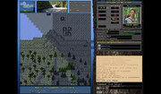
Local terrain map, which is often referred to as the zoomed-in map, displays the adventurer in the middle and his detailed surroundings. It's the map where most interactions with the game world happen. It's possible to zoom-out from this map to the wilderness map with the Enter key.
Note that in the game window, this map is titled Zoom map but during gameplay, e.g. when trying to climb a tree in wilderness map, it's referred to as local terrain map.
Wilderness map
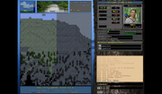
Wilderness map, often referred to as the zoomed-out map or overland map, gives a general view of the area surrounding the adventurer. It's good for finding areas of interest like water, settlements and different terrain types, e.g. pine mires. The adventurer's field of view is naturally affected by his surroundings: visibility through spruce mire is poor, but climbing a hill gives an excellent view. It's possible to zoom-in from this map to the local map with the Enter key.
Map of known areas
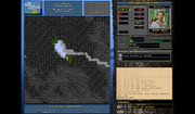
Map of known areas, sometimes referred to as the world map, can be accessed by the F6 key during gameplay. It shows all the areas known to the adventurer and has marks on interesting features such as settlements, shelters, quest areas and caves. It's also possible to toggle cultural regions overlay to display areas inhabited by different cultures in different colors.
If the adventurer gets lost, either due his own wanderings, or due to getting mugged, one can use this map to get one's bearings. It is unknown how the adventurer keeps this map updated and with him all the time. (The author's theory is that the map is tattooed upside down to an adventures abdomen and thorax for easy access in all situations. However, the author doesn't have an idea about how the tattooing would happen. Possibly spirit magic is involved.)
World map
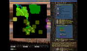
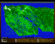
World map is the map shown during game world creation, indicating the location where the player's adventures begin within the world. From this map, it's possible to identify rivers, rapids, fords, settlements, fields and other terrain features like mountains. It's possible to toggle cultural regions to show a color coded overlay of areas inhabited by different cultures. This map is also the basis of the map of known areas.
